
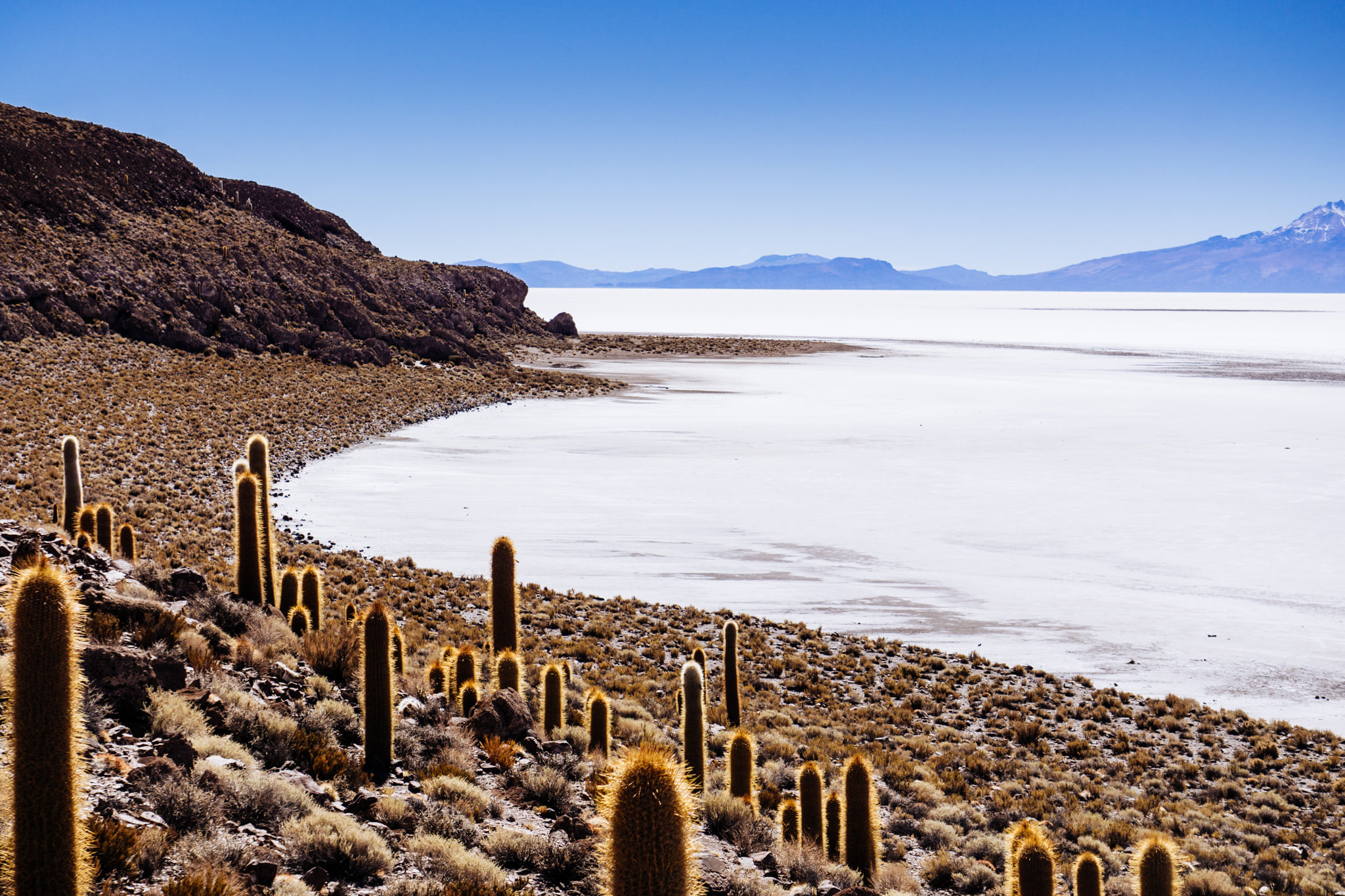
Salar de Uyuni in Bolivia at above 3600 m elevation is the world’s largest salt flat (12,106 square km). It is so vast and perfectly flat that the space satellites use it to calibrate their altimeters. Underneath the thick salt crust is a lake of brine containing over 50% of the world’s lithium deposits, a mineral used to make batteries. Many analysts say that Bolivia has the potential to become the Saudi Arabia of lithium.
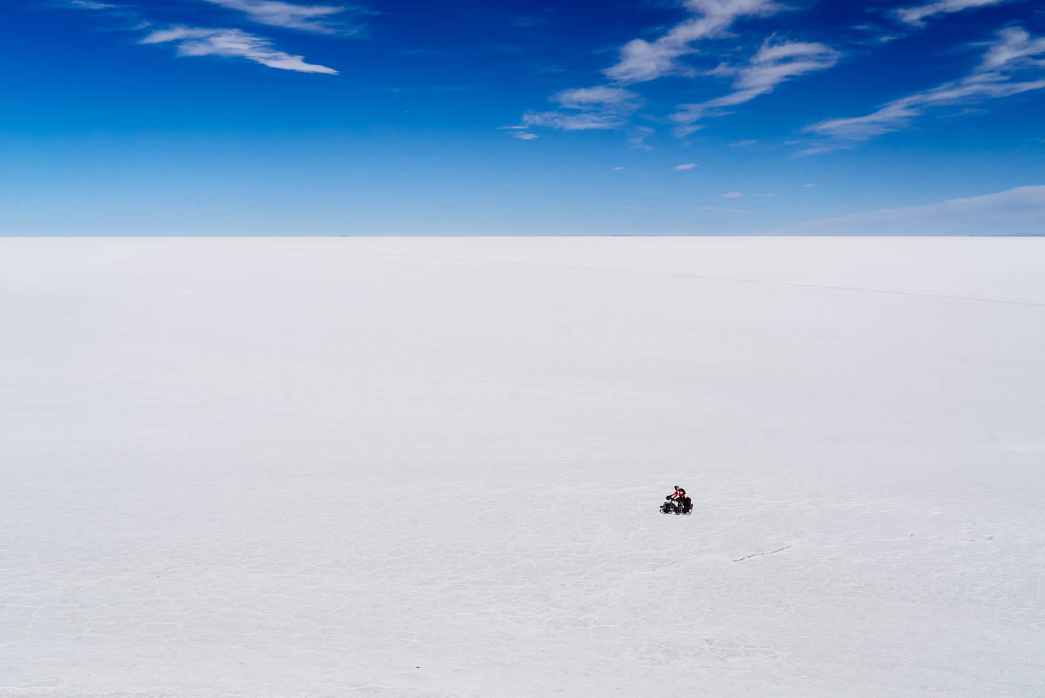
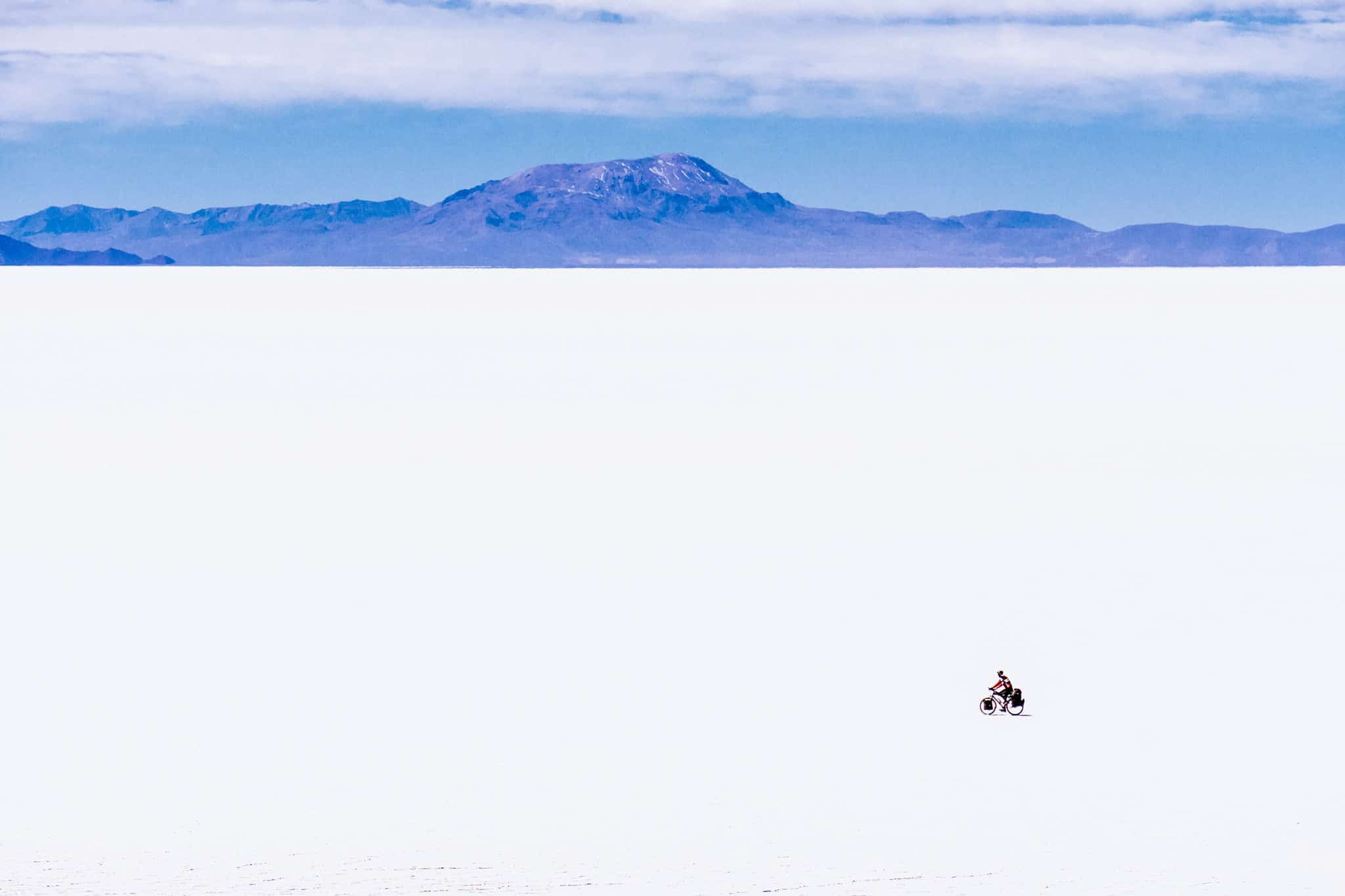
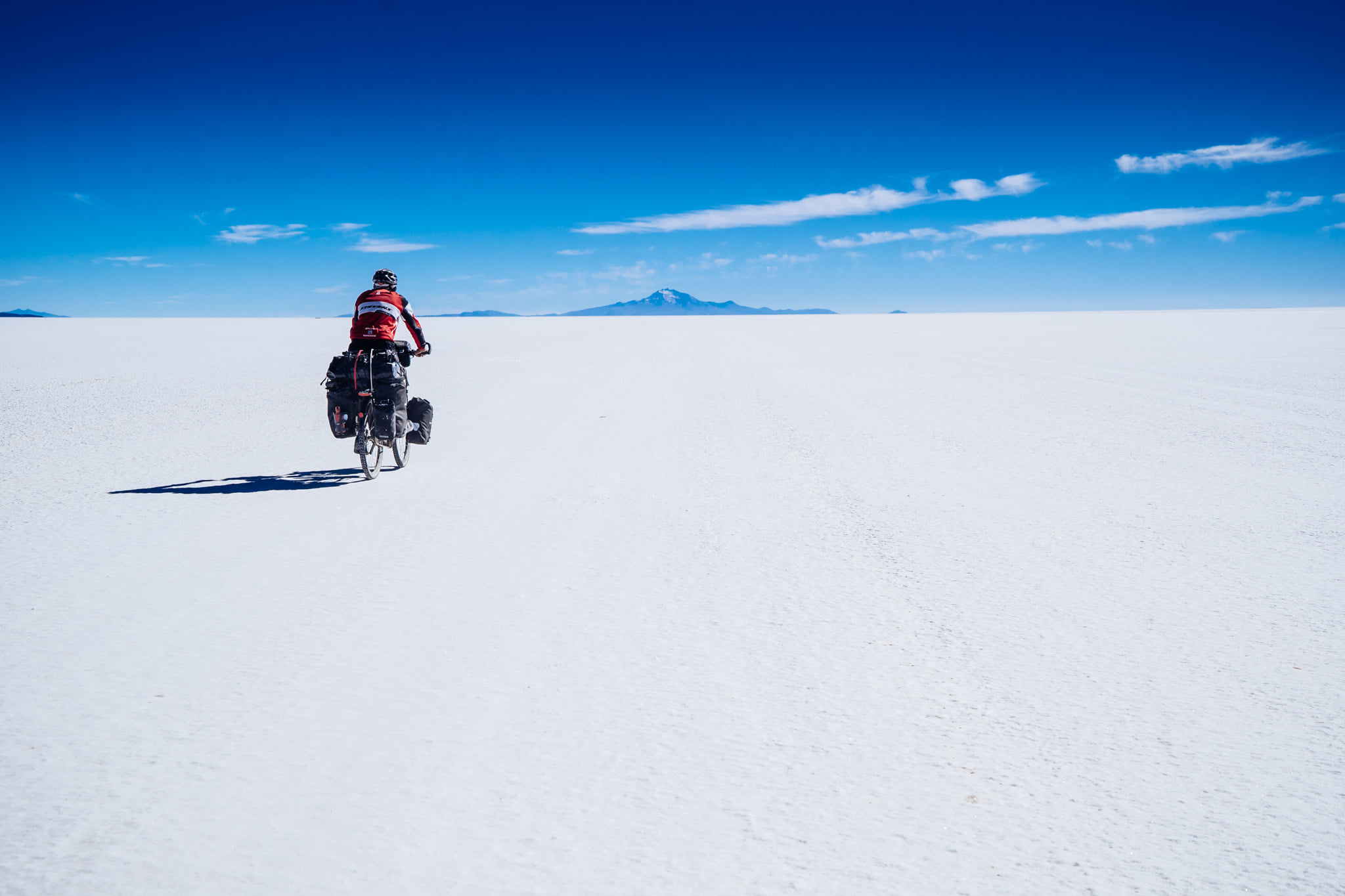
Riding a bicycle through the Salar is a surreal experience as there is nothing except a pure white land reaching far beyond the horizon and a blue sky. With no reference point in sight and clean air, you would lose the sense of depth and perspective; the islands in the salt flat appeared deceptively close yet took hours to reach by bike. It was over 100 km of the ride in the straight line.
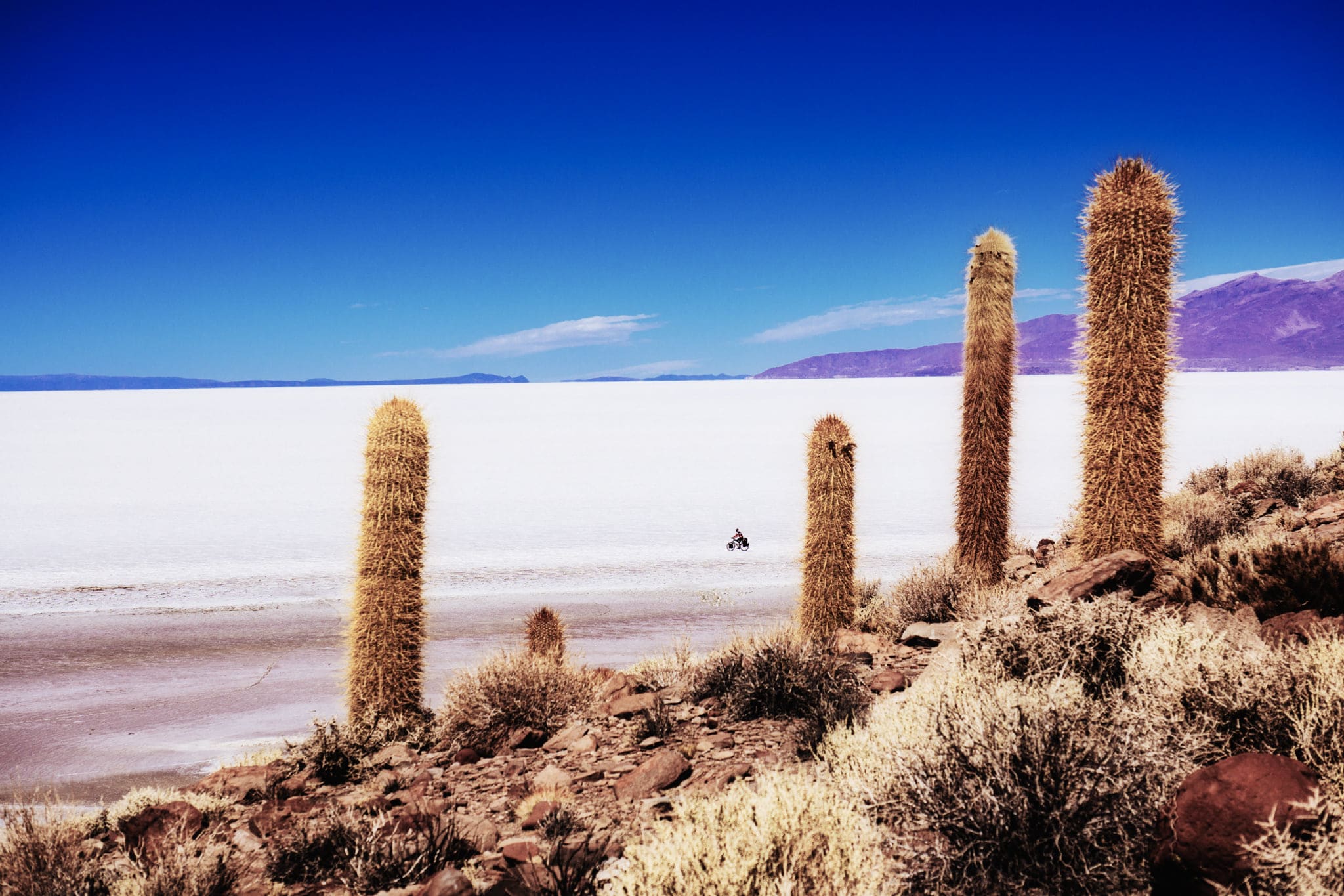
There are a couple of small islands within the Salar. On one occasion, I climbed up an island hoping to find a vantage point to take a panoramic picture of me cycling the Salar. There were many cacti on it, so I had to hike further up to get a clear viewpoint. I set up the camera on the tripod and left it with an interval shooting of every 30 seconds. It was only while coming down the island I realised how far I had gone. It took me about 7 minutes to get to the bicycle and cycle far away enough. As I had no reference point, I just cycled around with the hope to be in one of the photos. After making a few circles, I cycled back but had no clue where the camera was. I had lost sight of it. Besides, there were far too many cacti to spot a tripod. After searching for it in panic for several minutes, I heard a click. I paused and held my breath. Then I heard another click. I took a few more steps and scanned around. And there it was, still taking photos!
I ran towards the camera as if to hug it. When I looked at the screen, were only two shots out of many in which I was in the frame. The following photo is one of the two, captured on a Sony A6000 at 168mm (equivalent to 252mm full frame) so you can see how far I was from the camera that took me 18 minutes to find after I had left it on the hill.
Beautiful. I’ve always wondered how you take those camera shots from high up of yourself. I thought you had a drone